Struve Geodetic Arc point
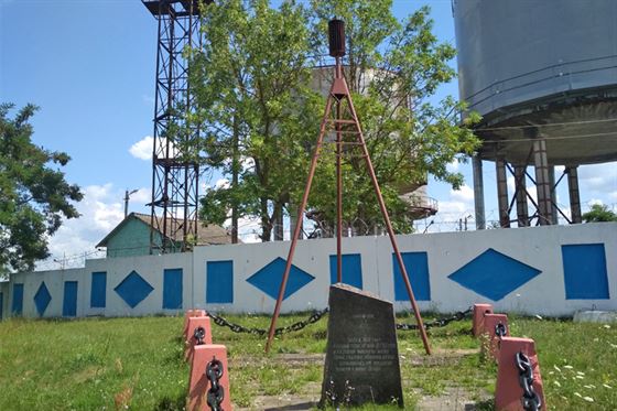
Struve Arc is an interesting landmark, one of the parts of which is located in the city of Ivacevičy. The memorial sign of the Struve Arc point was installed in 1930 at the place where in 1830 the geodesist and astronomer Vasily Yakovlevich Struve made his measurements.
Struve Arc is a large-scale project initiated by the Russian and German astronomer and geodesist Vasily Struve (Friedrich Georg Wilhelm Struve). The project is a system of two hundred sixty five triangulation parts – two-meter stone cubes buried in the ground. The Arc was created to determine the key parameters of the Earth as a planet: its shape and size. And today the Arc is the most accurate degree measurement of the meridian arc in the world.
The construction of the Arc was started in 1816 and lasted forty years. Work on its measurement was carried out both by employees of the Derpt and Pulkovo Observatories, and by Vasily Struve himself, who headed both of these observatories.
The length of the Arc is 2 820 kilometers. It starts from the coast of the Black Sea and ends near the Arctic Ocean.
Thanks to the Struve Arc, absolutely accurate data about the size and shape of our planet were obtained. It is believed that the astronomer’s project is one of the greatest achievements not only of astronomy, but also of geodesy and geography. Thanks to it, cartography received a significant impact in development.
In total, 31 points of the Struve Arc were located on the territory of Belarus. At the moment, there are only 19. Three of them are located in the Ivacevičy district – in the villages of Vialikaja Hać and Doŭhi, and also in Ivacevičy itself.
Publication date: 03.07.2020.
For convenient navigation through the landmarks, use the FREE mobile program